Introduction
As winter descends upon much of the northern United States, understanding snowfall is crucial for safety and planning. Snow accumulation maps play a vital role in forecasting and informing the public about potential weather hazards. These maps not only provide vital data for individuals and communities but also guide local governments and services in response planning.
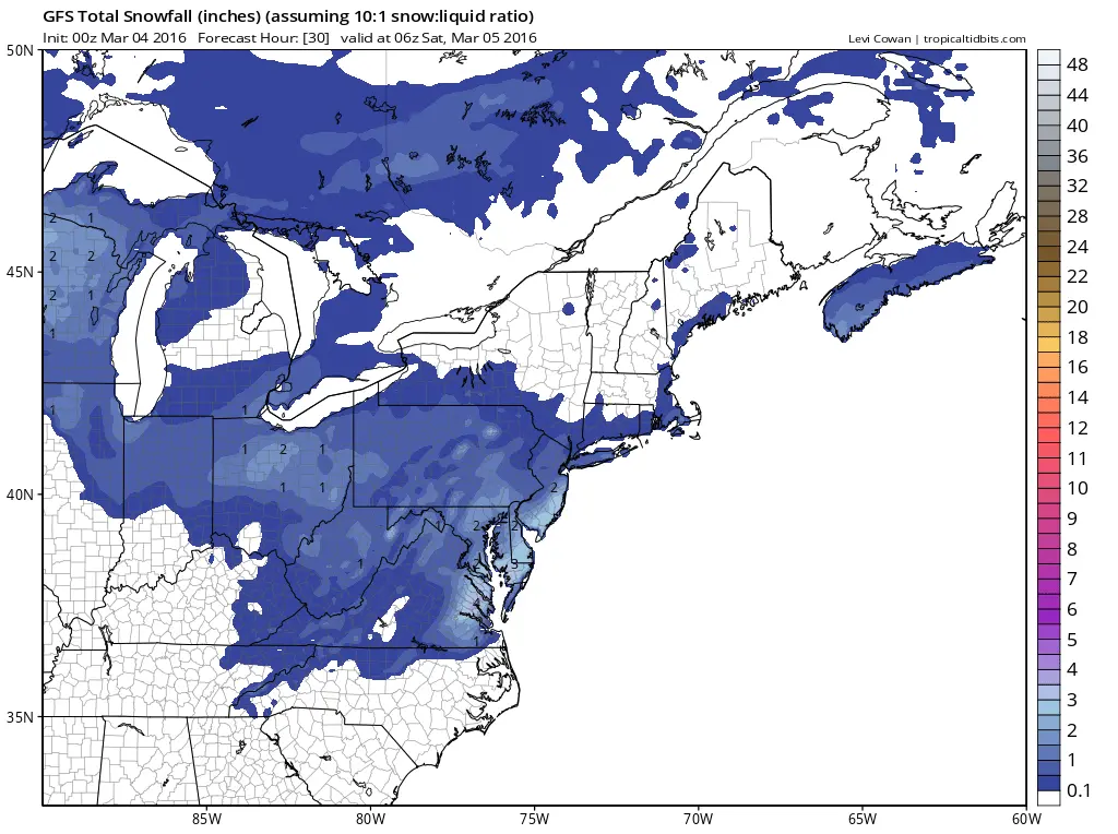
What is a Snow Accumulation Map?
A snow accumulation map visually represents the expected amounts of snow that will fall over a designated area during a specific period. This information is derived from meteorological models and real-time observations. Snow accumulation maps are pivotal for residents in impacted areas as they prepare for winter storms, helping them determine when to stock up on supplies or to stay indoors.
Current Events and Developments
Recent forecasts from the National Weather Service (NWS) indicate an extensive winter storm impacting the Midwest and Northeast regions of the U.S., with some areas expecting up to 18 inches of snow by the end of the week. Various state meteorological departments have released maps outlining expected snow accumulation, with Michigan and New York being of particular concern due to projected snowfall rates exceeding one inch per hour in certain locations.
Several communities are already preparing for potential disruptions, including transportation delays and power outages. Local officials, following snow accumulation maps and guidance from forecasts, are advising residents to take safety precautions. Emergency services are on standby, and utilities companies are coordinating to ensure rapid responses to any outages that arise from the expected heavy snowfall.
Conclusion
Snow accumulation maps are powerful tools that help individuals and communities prepare for winter weather. As storms grow increasingly unpredictable due to climate change, these maps will become even more critical in ensuring public safety. It is vital for residents in affected areas to stay updated with the latest forecasts and heed instructions from local officials. By doing so, individuals can better protect themselves and their families during severe winter weather events. As this winter unfolds, keeping an eye on these maps will provide insights not just into current conditions but also into the accessibility and safety of travel and outdoor activities.