Introduction
Weather maps are vital tools used in meteorology to visualize atmospheric conditions. They play a crucial role in weather forecasting, helping both meteorologists and the general public understand changing weather patterns. With the increasing unpredictability of weather due to climate change, accurate and accessible weather maps have never been more relevant.
Understanding Weather Maps
Weather maps come in various forms, including surface maps, satellite imagery, and radar maps. Each type conveys essential information about temperature, pressure systems, precipitation, and wind directions. For instance, surface maps display high and low-pressure areas, which are critical for predicting weather events such as storms. Satellite imagery allows for real-time observation of cloud cover and moisture patterns, while radar maps detect precipitation intensity and movement.
Recent Developments
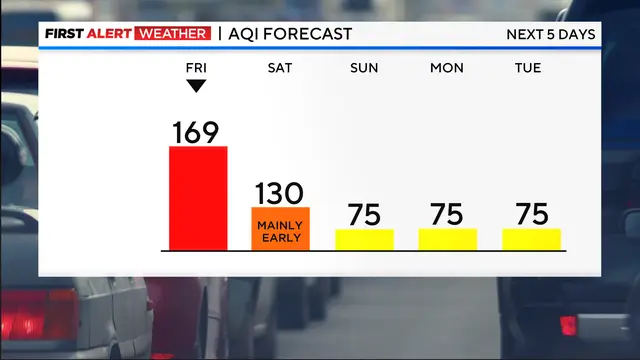
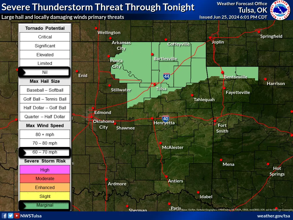
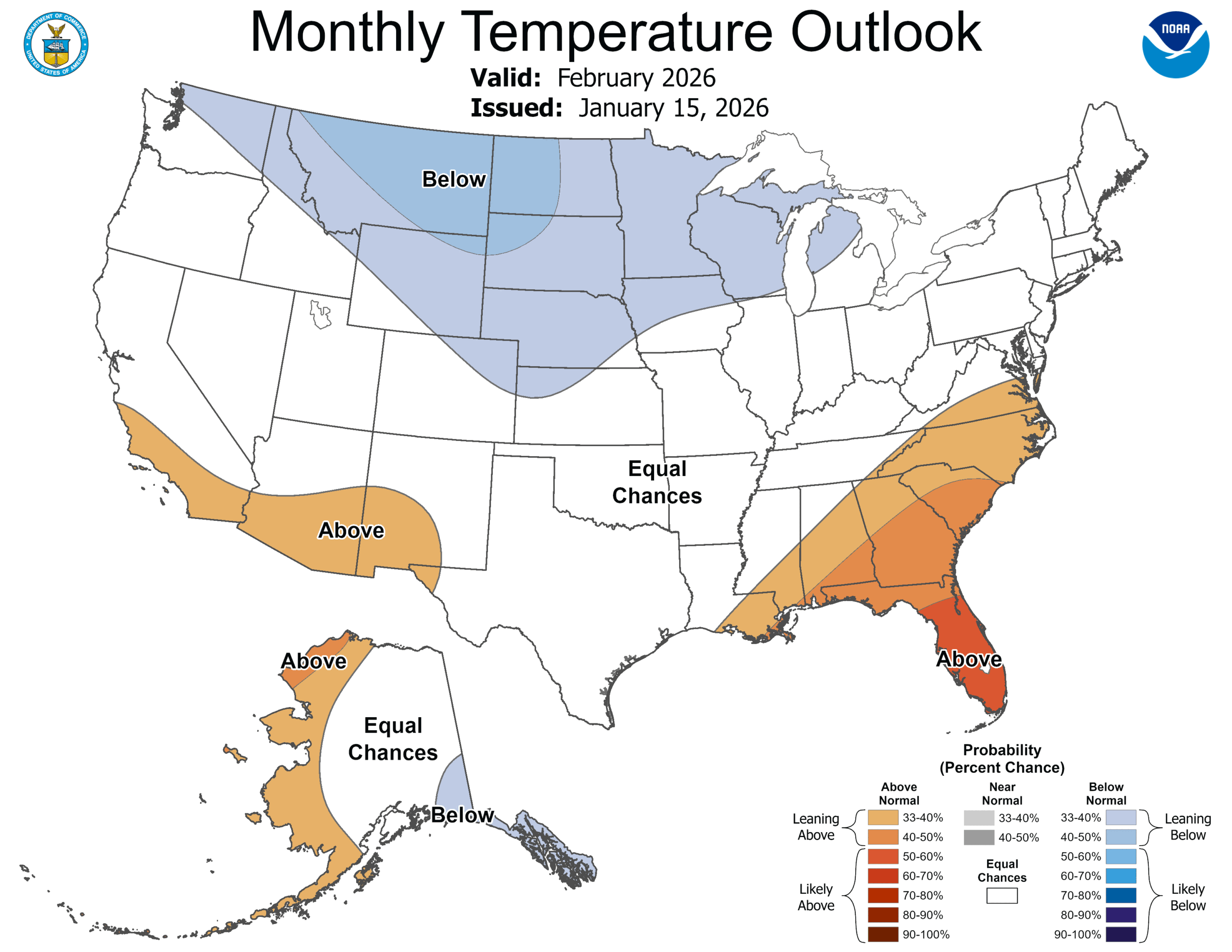
In recent weeks, weather maps have highlighted several extreme weather patterns across the United States. A significant cold front followed by a heatwave impacted the Midwest and Northeast, with temperature fluctuations of over 30 degrees Fahrenheit in a matter of days. The National Weather Service (NWS) has been using updated weather maps to communicate these rapid changes effectively. These maps have been instrumental in providing timely warnings about severe thunderstorms and tornadoes, which have become increasingly common during this transitional season.
Impact on Communities
Weather maps are not only beneficial for meteorologists; they significantly impact day-to-day life for individuals and businesses. Farmers depend on accurate forecasts for planting and harvesting schedules, while event planners rely on weather predictions to prepare for potential rain or storms. Furthermore, recent research has shown that communities with access to effective weather maps tend to respond better to adverse weather conditions, demonstrating their importance in disaster preparedness.
Conclusion
In summary, weather maps are indispensable in understanding and predicting weather phenomena, especially as climate extremes become more common. Their accuracy and detail help individuals and communities prepare for both short-term and long-term weather events. As technology advances, we can expect to see even more refined and accessible weather maps, ensuring that everyone remains informed and prepared for whatever nature might bring.