A tornado watch has been issued for southeast Iowa, including Iowa City, until 8 p.m. Central time. This alert indicates that atmospheric conditions are favorable for the development of tornadoes.
Earlier today, a tornado warning was issued at 2:38 p.m. for northeastern Wayne County, set to remain in effect until 3:15 p.m. The severe thunderstorm associated with this warning was reported to be over Corydon, moving northeast at 55 mph.
According to the National Weather Service (NWS) in Des Moines, damaging wind gusts, large hail, and isolated tornadoes are possible this afternoon into the evening hours. “TAKE COVER NOW! Move to a basement or an interior room on the lowest floor of a sturdy building,” urged the NWS.
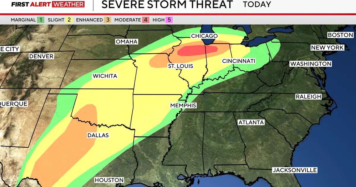
The tornado watch encompasses multiple counties in southern and eastern Iowa, with the potential for severe storms to impact major cities including Chicago, St. Louis, Detroit, and Indianapolis.
Bill Deger from AccuWeather noted, “Severe storms today could impact Chicago, St. Louis, Detroit, and Indianapolis.” Observers are particularly concerned about the danger posed by flying debris, which will be hazardous to those without shelter.
Mobile homes are expected to be at risk of damage or destruction during the tornado warning. The storms are anticipated to exit the area around 7-8 p.m., but the threat does not end there.
Tomorrow has been designated as a weather alert day due to another risk for severe storms, with a 3 out of 5 enhanced risk level indicated for the region. Wind gusts could reach up to 70 miles per hour, and current temperatures are around 51 degrees, with a high of 64 degrees expected in Lamoni.
As the situation develops, residents are advised to stay tuned for updates from local weather services and heed all warnings issued by officials. Details remain unconfirmed regarding the extent of damage or any injuries at this time.