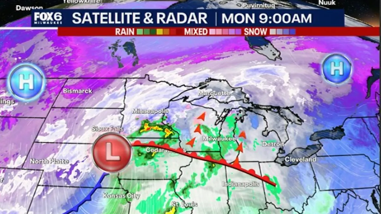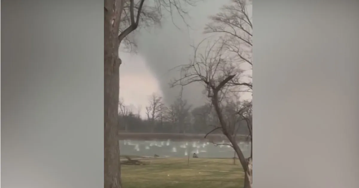
A tornado warning was issued for New Jersey’s Monmouth and Ocean counties on March 16, 2026, as severe storms swept through the area, causing widespread damage and power outages. Peak wind gusts reached 72 mph at John F. Kennedy International Airport, contributing to the dangerous conditions.
As a result of the storms, approximately 12,459 customers were left without power in New Jersey’s JCP&L service area, while PSE&G reported 11,903 affected customers. In addition, PSEG Long Island had 14,466 customers without power, highlighting the extensive impact of the severe weather.
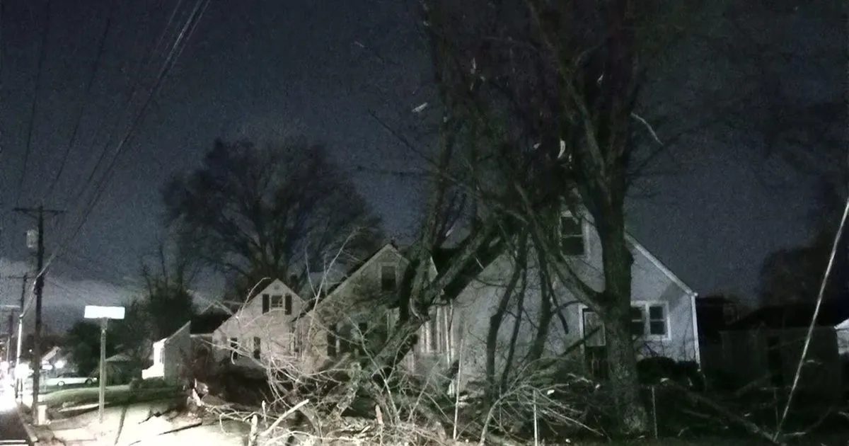
During the storm, a tree fell and crushed a car in the Bronx, and another tree toppled onto a house in South Plainfield, New Jersey. These incidents illustrate the destructive nature of the weather that affected not only New Jersey but also neighboring areas.
The National Weather Service had issued a tornado watch for most of New Jersey, which remained in effect until 7 p.m. on the same day. Tornadoes in New Jersey are not uncommon, occurring a couple of times each year, with the most recent tornado registered by the NWS occurring on May 16, 2025, near Buena Vista Township in Atlantic County.
Wind gusts were forecasted to reach 50 mph on March 16, 2026, but the actual gusts exceeded expectations, with Newark recording peak gusts of 71 mph. This level of wind speed can cause significant damage, especially in urban areas.
As the storm system moved through the region, emergency services were on high alert, and residents were advised to stay indoors and monitor local weather updates. The situation remains dynamic, and details regarding the full extent of the damage and any potential injuries are still being assessed.
Authorities are working to restore power and clear debris from roadways, but challenges remain due to the ongoing severe weather conditions. Observers expect further updates as assessments continue and recovery efforts are initiated.
Details remain unconfirmed regarding the total impact of the storm, but the situation is being closely monitored by local officials and the National Weather Service.