Tornado Warnings in Effect
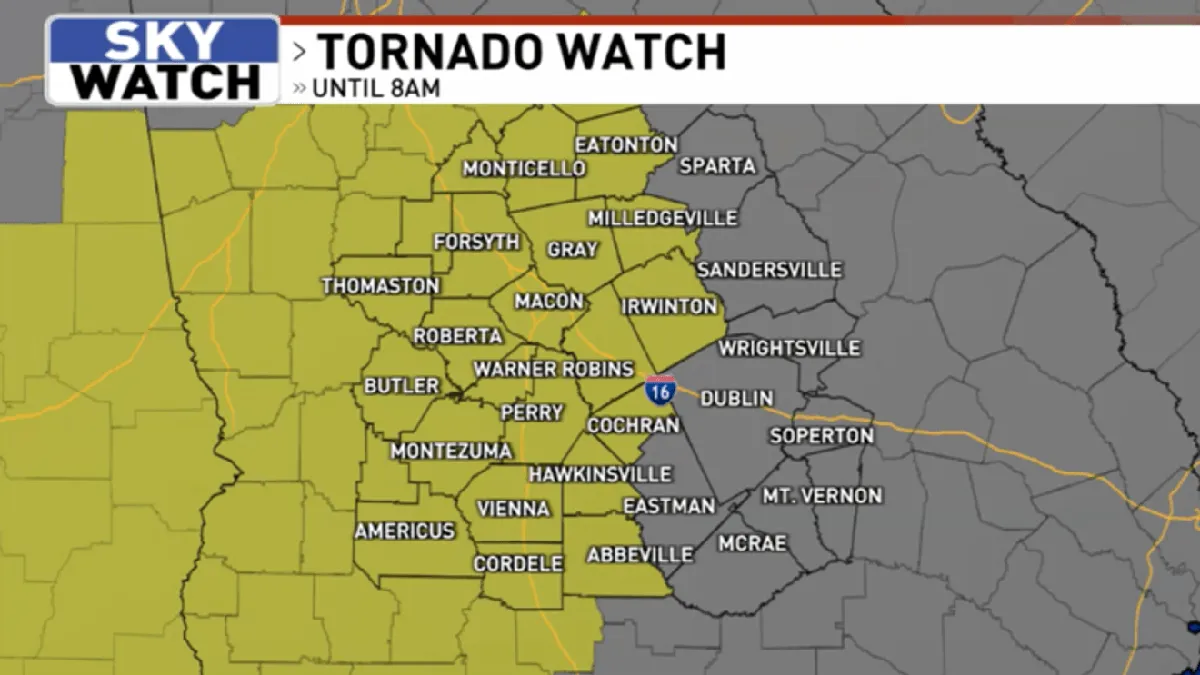
A tornado warning has been issued for multiple regions, including Middle Georgia, the D.C. area, southeast Louisiana, and south Mississippi, as severe weather conditions develop. The warnings were announced early on March 12, 2026, with a Tornado Watch in effect for much of Middle Georgia until 8 AM.
In Middle Georgia, damaging winds of 60–70 mph are expected, along with the possibility of isolated severe hail, particularly with stronger discrete storms. A few brief spin-up tornadoes within the storm line are also possible, raising concerns among local meteorologists.
In the D.C. region, a tornado watch has been issued for parts of Maryland, including Montgomery, Howard, Frederick, and Carroll counties, as well as Loudoun County in Virginia. Record high temperatures were recorded in the area on March 11, reaching 85 degrees at Reagan National Airport, which may contribute to the severe weather conditions.
Mike Stinneford, a meteorologist, warned, “Damaging winds, large hail, and even an isolated tornado are all possible.” He emphasized the seriousness of the situation, stating, “This is a very dangerous situation.” A rotating storm cell was reported over Frederick County, Maryland, indicating the potential for severe weather development.
Meanwhile, southeast Louisiana and south Mississippi are also under a Tornado Watch, with scattered severe thunderstorms expected. Rainfall in certain Bayou spots could reach 1-2 inches, further complicating the weather scenario.
As March tends to be topsy-turvy with fluctuating temperatures, residents are urged to stay alert and monitor local weather updates. The National Weather Service continues to provide updates as the situation evolves.
Details remain unconfirmed regarding the exact path and intensity of the storms, but officials are advising residents to prepare for potential severe weather. The public is encouraged to seek shelter and stay informed through reliable weather sources.