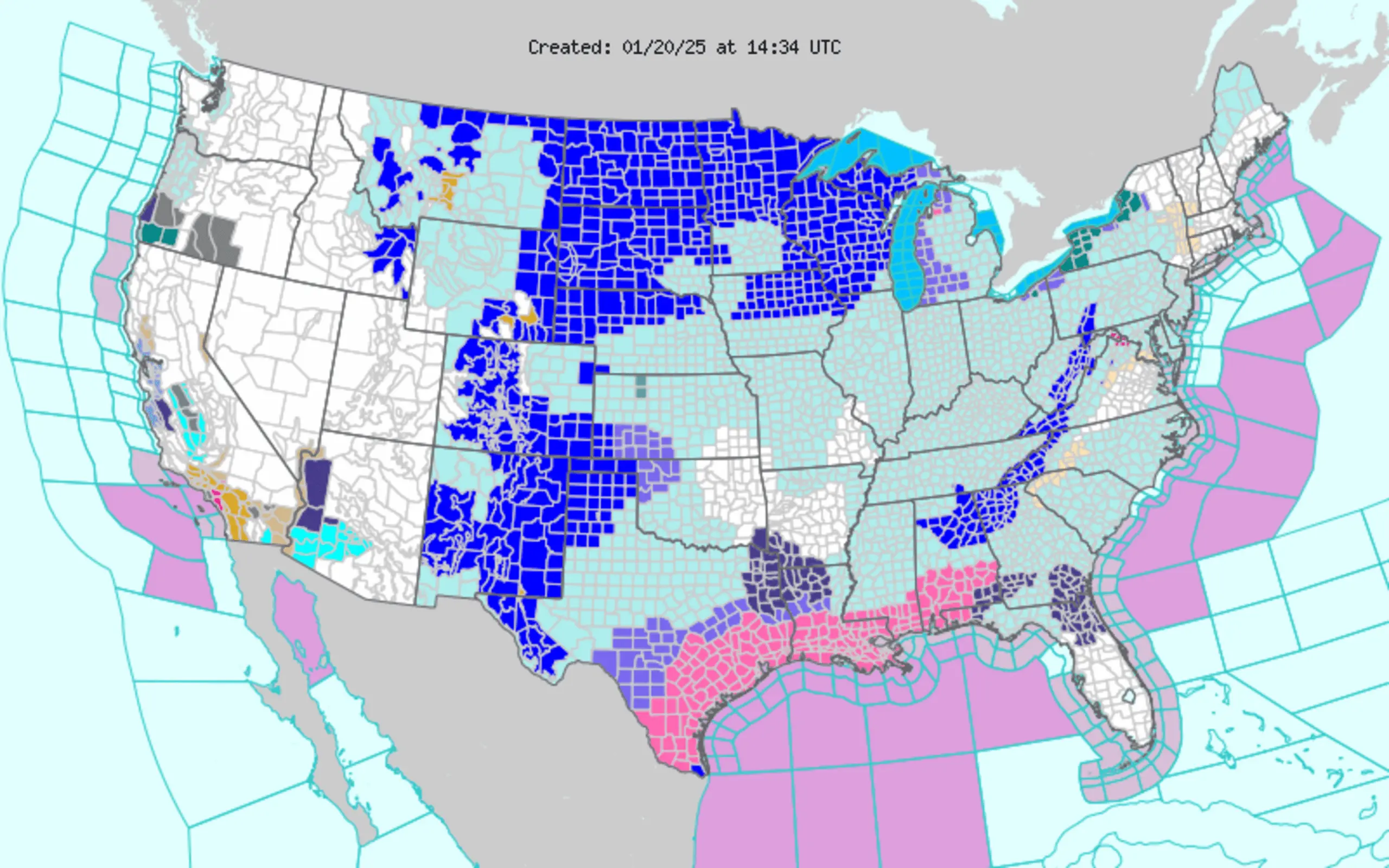
A winter storm watch has been issued for southern Erie County, set to take effect at 8 p.m. on March 16 and lasting until 8 a.m. on March 18. Heavy lake-effect snow is anticipated, with accumulations ranging from 5 to 9 inches in various locations within the county.
Winds from the west are expected to gust between 35 mph and 45 mph through the morning of March 17, potentially creating hazardous conditions for travel and outdoor activities.
In Chicago, a Blizzard Warning that was previously in effect for Boone, DeKalb, and McHenry counties has been cancelled. However, a Winter Weather Advisory remains active for Cook, DuPage, Grundy, Kane, Kendall, Lake, La Salle, Livingston, and Will counties until 1 p.m.
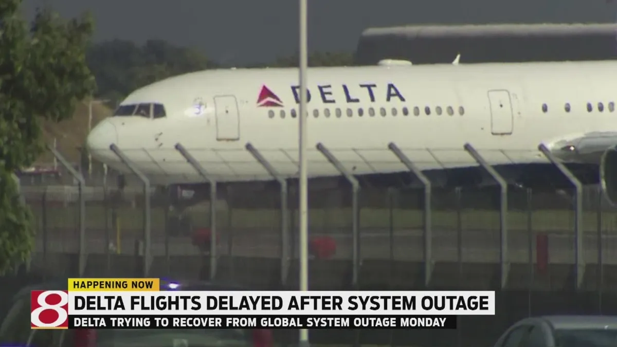
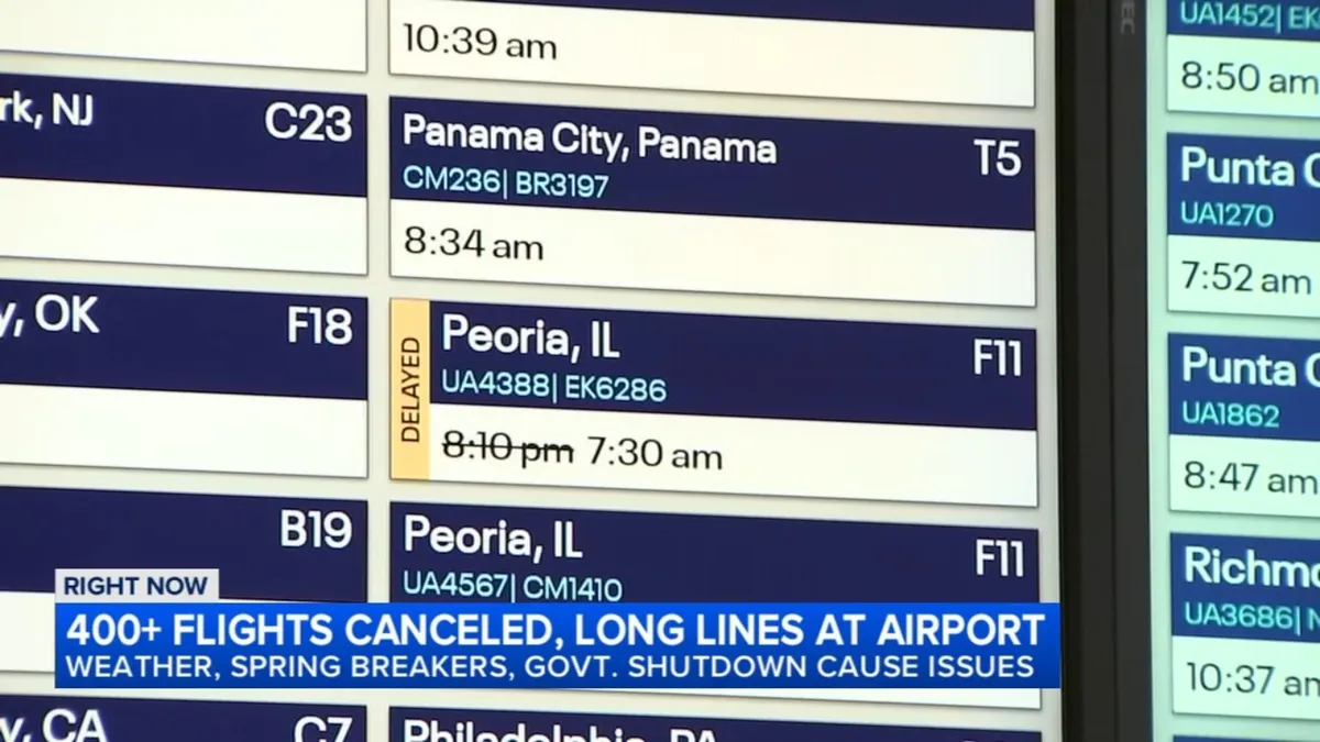
Recent snowfall totals in the Chicago area have included 6 inches in Harvard, 5.7 inches in Spring Grove, and 4 inches in DeKalb. These conditions have led to significant disruptions, including the cancellation of 406 flights at O’Hare and 31 flights at Midway due to winter weather.
Illinois Tollway Executive Director Cassaundra Rouse stated, “Our crews will be working throughout this storm to keep our roads clear and safe so our customers can safely complete their travels.” She also urged travelers to reduce their speed and remain vigilant about changing weather conditions.
In addition to the travel disruptions, the severe weather has also been linked to a partial house collapse on the South Side of Chicago near 69th Street and South Washtenaw Avenue, highlighting the dangers posed by the storm.
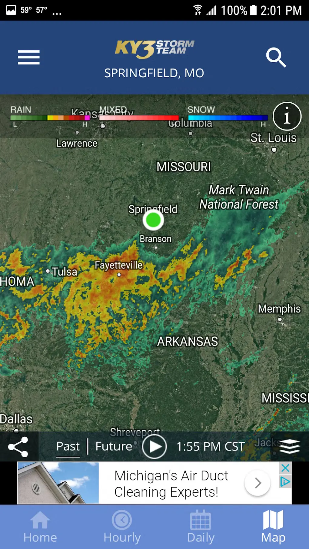
As the storm progresses, a major winter weather system is expected to continue affecting the upper Midwest and the upper Great Lakes. In Michigan’s Upper Peninsula, snow totals could reach as high as 18 inches.
Details remain unconfirmed regarding the full extent of the storm’s impact, but residents are advised to prepare for continued adverse weather conditions.