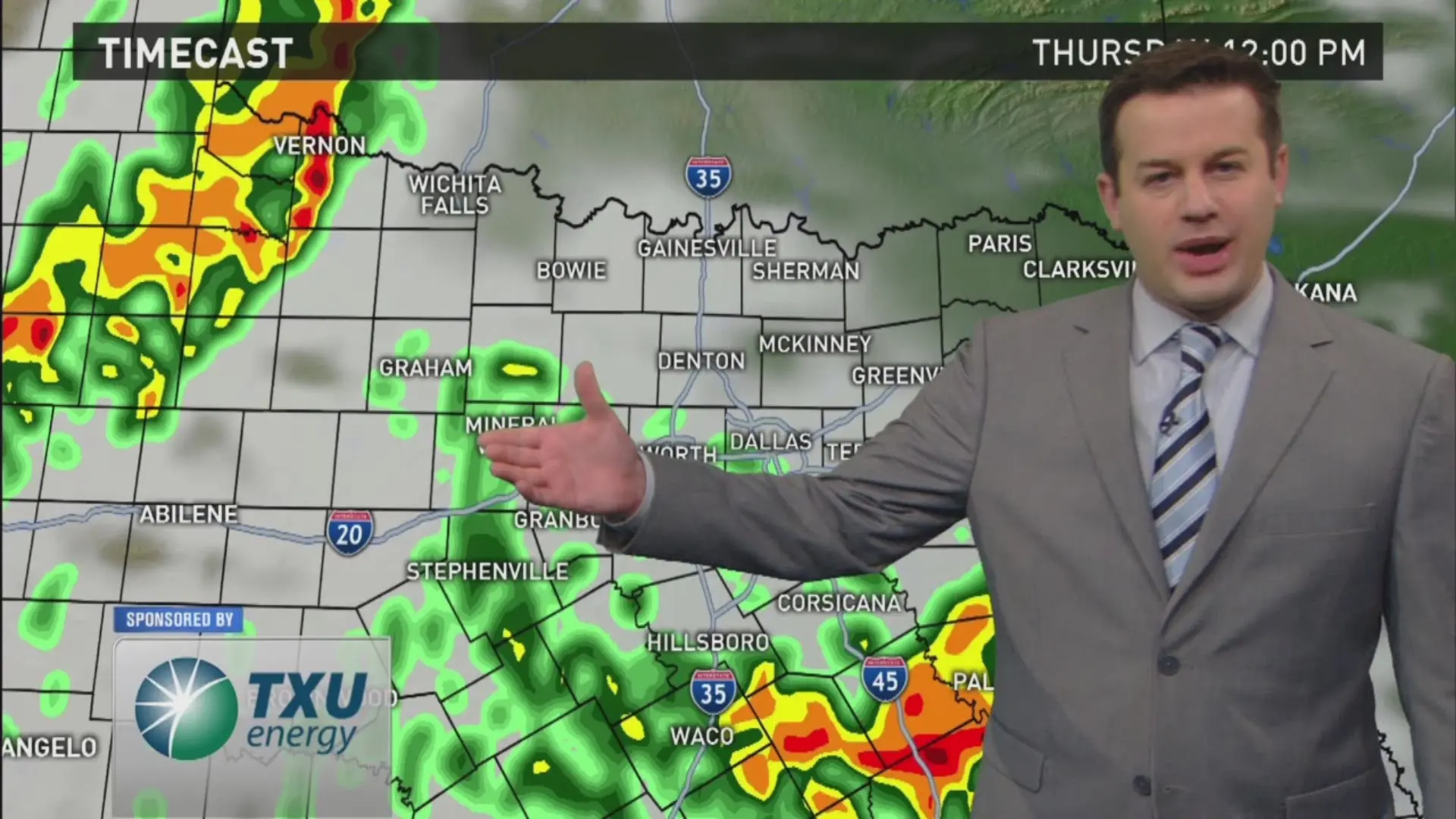
Nashville is facing significant weather challenges as a wind advisory and tornado watch are currently in effect. What does this mean for residents? The National Weather Service has indicated that severe thunderstorms are expected to roll through the area, bringing with them the potential for damaging winds and even tornadoes.
A tornado watch has been issued for parts of Tennessee, including metro Nashville, until 3 a.m. This alert comes as a line of storms near the Mississippi River is forecasted to arrive soon, with wind gusts potentially exceeding 75 mph in Middle Tennessee.
As the storms approach, temperatures are expected to drop significantly. Following the severe weather, snow showers are anticipated on Monday, with light snow possibly leaving a grassy dusting across the area by morning. Temperatures are projected to fall into the teens to low 20s on Monday night, marking a stark contrast to the conditions leading up to the storms.
According to meteorologist Barr, “Temperatures are going to fall into the teens to low 20s on Monday night,” highlighting the rapid change in weather patterns. This severe weather threat is expected to be intense but short-lived, with the severe weather threat projected to end by 2 a.m. Monday.
Residents are advised to stay informed and take necessary precautions as the situation develops. The severe weather outlook indicates a high confidence in damaging winds and tornadoes in the Nashville area, making it crucial for individuals to remain vigilant.
Details remain unconfirmed regarding the extent of the damage or any potential injuries resulting from the storms. As the situation unfolds, updates will be provided to keep the public informed about the Nashville weather conditions.