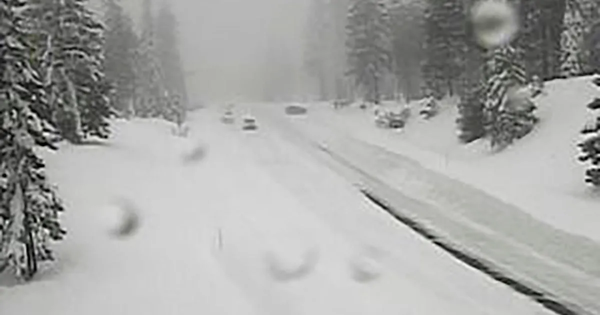
A winter storm warning is in effect for parts of northern and central California, particularly impacting the Sierra Nevada region. The National Weather Service (NWS) has issued this warning for elevated mountain areas, including the West Slope Northern Sierra Nevada and Western Plumas County/Lassen Park, specifically above 4500 feet.
Significant snow accumulations are anticipated, with an additional 12 to 18 inches expected above 4500 feet and up to 2 feet at the highest peaks. Winds are also a concern, with gusts potentially reaching as high as 45 mph.
The warning is set to last until 11 p.m. local time on April 12. Travelers are highly discouraged from venturing out due to slick road conditions, which could lead to treacherous travel situations.
On April 11, the UC Berkeley Central Sierra Snow Lab reported nearly eight inches of snow, indicating the storm’s intensity. The NWS had initially launched a winter storm watch alert for the Sierra Nevada on April 10, highlighting the potential for hazardous weather.
Officials have warned that whiteout conditions are expected, with visibility potentially dropping below a quarter mile, making travel not only difficult but potentially life-threatening. Additional snow accumulations of up to 14 inches are expected, alongside the already reported conditions.
The storm is anticipated to continue impacting the region into Sunday evening, with widespread snow accumulations above 4500 feet ranging from 1 to 2 feet, and possibly reaching 2 to 5 feet above 6000 feet.
Travelers are advised to delay travel if possible and to use extreme caution if travel is unavoidable. The ongoing storm highlights the Sierra Nevada’s reputation for dramatic weather swings, even in April.
Details remain unconfirmed regarding the exact impact of this storm as it progresses through the region. Residents are encouraged to stay updated with local weather reports and heed any warnings issued by authorities.